Connections
Lakeside living minutes from Cambridge
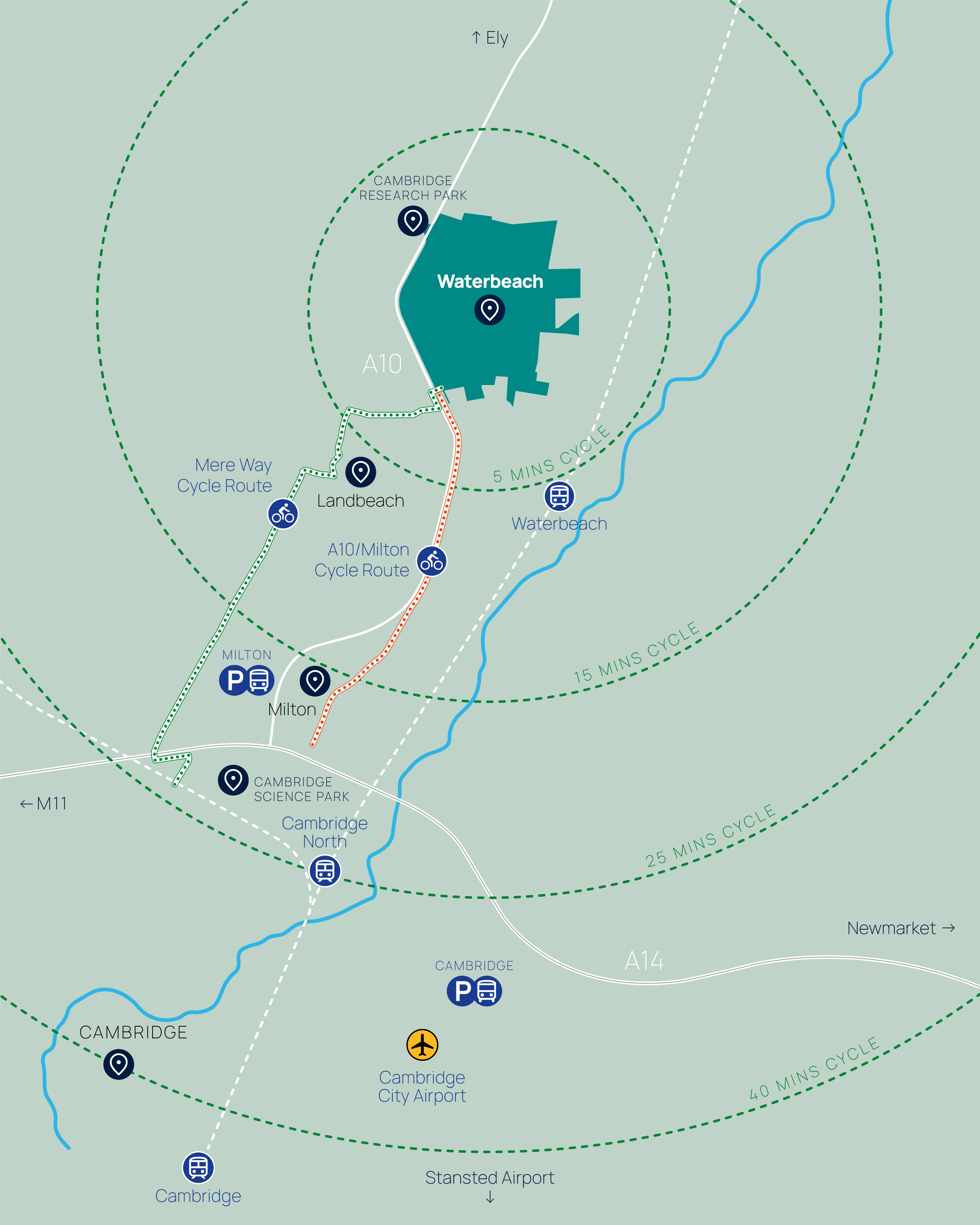
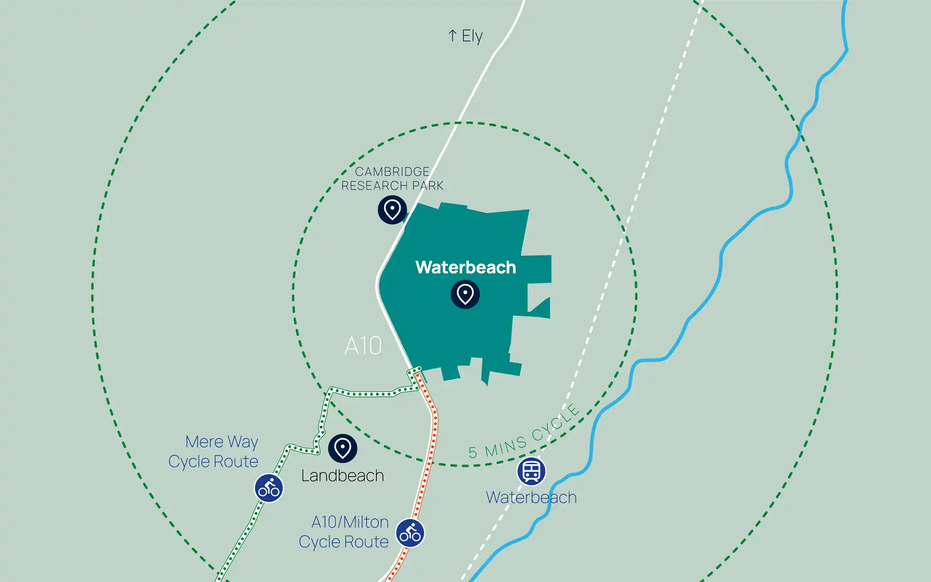
With purpose-built cycle routes to Cambridge and the Science Park; regular shuttle buses to Waterbeach rail station, Milton Park&Ride and Cambridge; and London just over an hour away by train, Waterbeach is one of the best-connected places in the county.
Transport connections
With investment in almost 40km of new and improved cycle connections, a new cycle bridge over the A10 to connect to the new Mere Way Cycle Route, and a Sustainable Travel Hub at the heart of the first phase, Waterbeach promotes healthy, active and car free travel options.
Mere Way helps connect communities by providing an important active travel route between Waterbeach and Landbeach, to Cambridge Science Park and beyond.
The next five years will see further investment in the active travel infrastructure around the development.
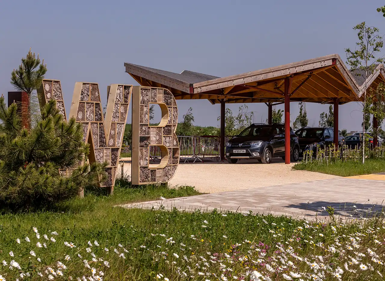
Sustainable Travel Hub
The Sustainable Travel Hub sits at the gateway to Waterbeach providing support, advice and options for you to leave your car at home — or at the Hub.
Helping you get around
Services currently at the hub include:
- Bus services
- Bike hire with App Bikes
- Free bike repair station
- Liftshare
You can also access our carbon calculator at the hub, to see how making small changes to your journeys can lead to a healthier community.
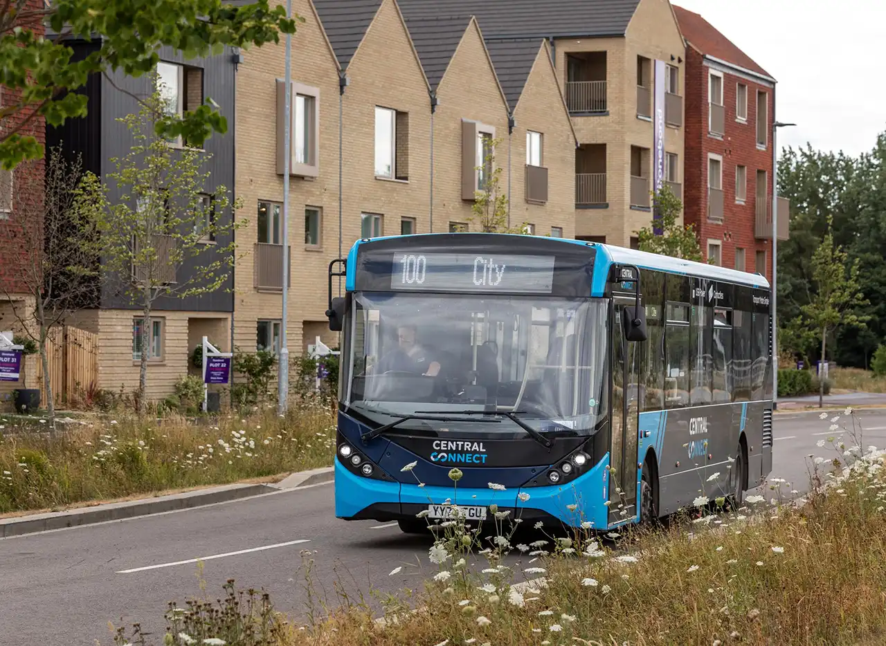
Bus services
A new half-hourly shuttle bus service connects to Waterbeach Station, the Science Park, and Cambridge City Centre – making it easier to leave your car at home and enjoy time travelling, without the added stress of driving.
Planning your journey
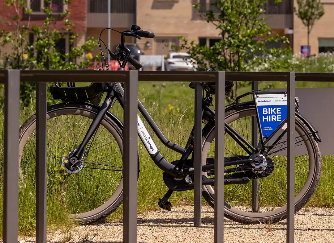
Bike hire with App Bikes
App Bikes are available at the Sustainable Transport Hub, by the Studio, outside the squash courts and in the Village (Outside Chung Hwa on Greenside). They are available for anyone to use, you just need to download the free App, register and get pedalling. Don’t forget to take a bike helmet with you and ride responsibly.
Urban&Civic is funding the first 30 minutes of each hire, after which it costs £1.00 for every 30 minutes.
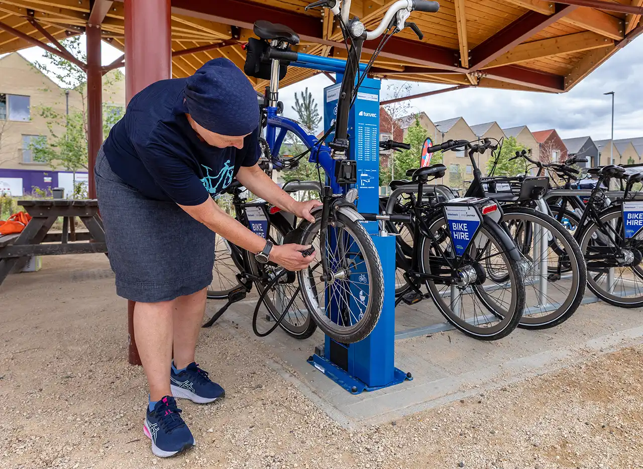
Bike repair and advice
Helping you get cycling confident and ready to ride away. There is a free bike repair station at the Sustainable Transport Hub where you can and use a range of tools to repair punctures and undertake general bike maintenance. Bike servicing workshops are also held as part of our community events.
Car Share
Liftshare supports new and existing residents in the area to car share as the driver, passenger or both. As more members join, the number of potential matches will increase. It’s a great way to save money, reduce CO₂ emissions and reduce stress caused by driving. Download the Liftshare Companion App and join your community: search for ‘Urban&Civic’ and click to join the Waterbeach community. Alternatively, find out more and sign up at www.liftshare.com/uk/community/waterbeach.

Residents are also able to access a range of incentives and initiatives to support and sustainable travel by registering with LocalGO
Future plans
Coming soon in Phase 1
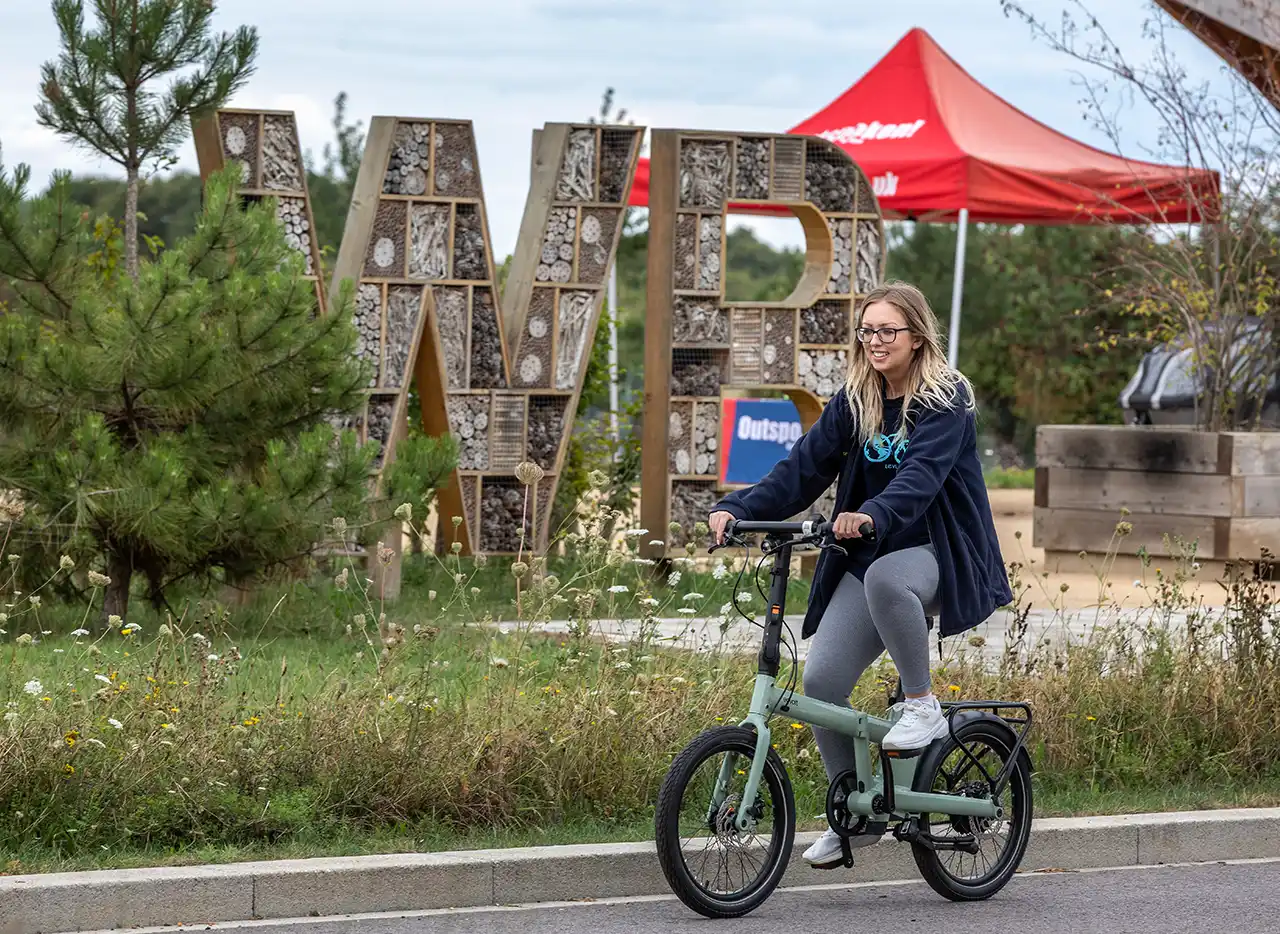
- e-bikes
- Electric car charge and car club
- Delivery lockers
- Bus information point
Waterbeach to Cambridge
Plans for a new busway and travel hub to connect Waterbeach, Landbeach, and Cambridge are being delivered by the Greater Cambridge Partnership (GCP). The scheme also includes a new walking and cycling route alongside the busway. The Hub will connect to the cycle routes from the development, with the development’s southern roundabout also serving as the gateway to the new Hub, located just on the other side of the A10.
Waterbeach Greenway
This scheme will provide new and improved walking, cycling and, where appropriate, equestrian links between Waterbeach, villages to the south and on to Cambridge, as well as links to employment sites and public transport hubs. It is one of 12 greenway routes in development across the Greater Cambridge area. Improvements to Cowley Road, which forms part of the greenway, are already underway.
Waterbeach Station relocation
The GCP is also supporting the relocation of Waterbeach Station, as part of the eastern side of the New Town development. The station will move north from its current location in the village to become part of the new development. Construction work on the station's infrastructure is scheduled to begin in the next few months.